5. Numeric Example
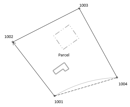
A crew surveyed the exterior of a parcel, Figure J-23. They assumed the coordinates of the southernmost corner (1001) and used the record bearing for the southwesterly line (1001-1002)
|
Figure J-23 |
|||||||||||||||
|
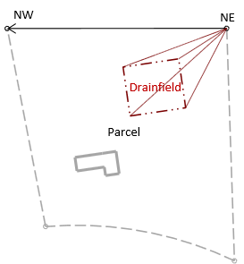
Later, a second survey crew was sent out to locate the existing drainfield. They did not have the first crew's coordinates so they occupied the northernmost corner (NE), for which they assumed coordinates, and backsighted the westernmost corner (NW), for which they assumed a direction. They then shot the drainfield corners. As a check, they also shot the distance from NE to NW. Figure 24 is a summary of their survey.
|
Figure J-24 |
Assumed dir NE-NW: N 90°00'00" W |
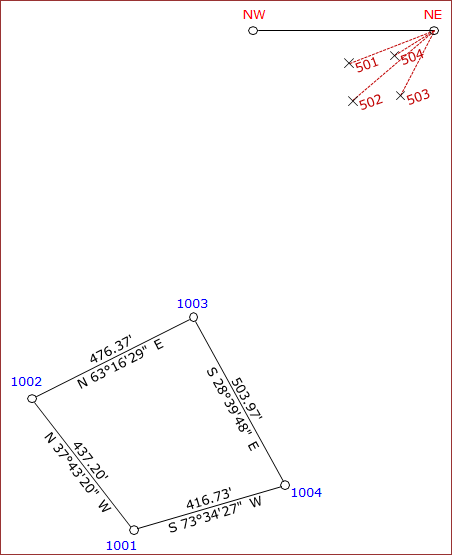
The data was combined in a CAD drawing with the result shown in Figure J-25.
|
|
|
Figure J-25 |
Using the boundary survey as the reference system, translate the drainfield data.
a. Determine transformation parameters
Step (1) Scale
Length of line NE-NW is 476.41', line 1003-1002 is 476.37'.
From Equation J-1:
![]()
This represents a distortion of 1/(1-0.999916) = 1/11,900. If this is within tolerance, then the scale factor can be ignored. We will apply it in this example.
Step (1) Rotation angle
Line NE-NW coincides with line 1003-1002; Convert the bearings to azimuths and compute the rotation angle.
| Line NE-NW | |
| Line 1003-1002 | |
|
Using Equation J-2
|
|
Step (3) Translations
Use the coordinates of points 1003 and NE in Equations J-3 and J-4 to determine the translations.
![]()
![]()
Step (4) Math check
For a parameters math check, convert NW to see if it matches the coordinates of 1002.
In the From system, NW's coordinates are:

Transform and check:
![]()
![]()
Yuo, it checks.
b. Using Equations J-5 and J-6 transform the drainfield corners: 501-504
Point 501
![]()
![]()
Point 502
![]()
![]()
Point 503
![]()
![]()
Point 504
![]()
![]()


 -
-