J. Coordinate Transformation
1. A typical scenario
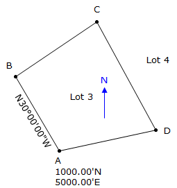
Surveyor Jones traversing Lot 3 in a subdivision assumes the coordinates of one property corner and the direction of a line, Figure J-1.
|
|
|
Figure J-1 |
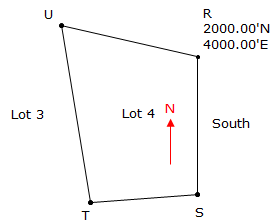
Later, Surveyor Davis is hired to map Lot 4 next door to the east. He assumes his own coordinates and line direction, Figure J-2.
|
|
|
Figure J-2 |
Both surveyors have good closure and compute coordinates for their lot corners.
Today, you are hired to do a survey in the vicinity of the two lots. Realizing that Jones' line CD and Davis' line TU are the same line, you decide to plot both their surveys in CAD (Computer Assisted Drawing). The result? Figure J-3.
|
|
|
Figure J-3 |
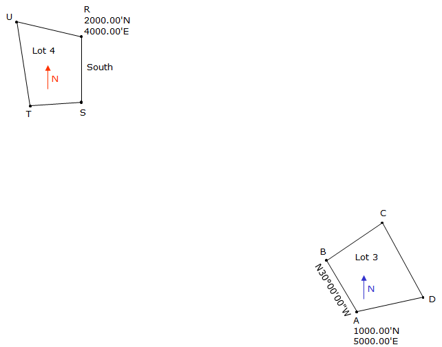
Something doesn't look right - the two lots are supposed to be next to each other.
What happened?
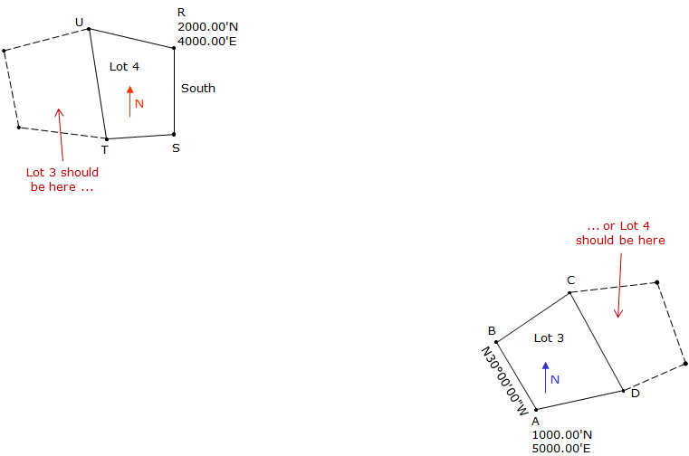
The two surveys are in separate coordinate systems. Since each surveyor assumed his own starting coordinate and direction independent of each other, they have different coordinate origins and meridian (North) direction. To resolve this problem we need to move Lot 3 into Lot 4's system or Lot 4 into Lot 3's system, Figure J-4, We also have the option of moving both to a third system.
|
|
|
Figure J-4 |
There are a few ways to do this. We could:
- reduce Davis' survey data using Jones' coordinate system
- perform a coordinate transformation.
Regardless of the method, we must know something about how both surveyors' systems are related to each other.