Page 1 of 3
C. A Perfect 2D Grid?
1. Defining a Grid Coordinate System
A grid coordinate system must be carefully designed to ensure that:
- grid and horizontal ground distances match
- grid and horizontal ground angles match.
These, in turn, preserve shape and area of measured quantities.
An "ideal" grid coordinate system should have these three characteristics:
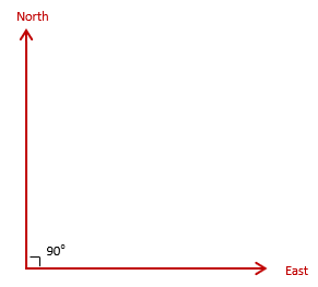
a. Orthogonal
The system consists of two reference axes are right angles to each other, Figure C-1
 |
| Figure C-1 Reference Axes |
These define Grid North and Grid East for the system.
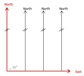
b. Parallel meridians
All meridians are parallel with the North reference axis, Figure C-2, with no convergence.
 |
| Figure C-2 Parallel Meridians |
Forward and back grid directions always differ by exactly 180°.
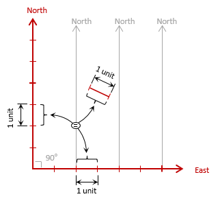
c. Uniform scale
A linear unit is the same physical length regardless its orientation, Figure C-3.
 |
| Figure C-3 Uniform Scale |