3. Computations
This isn't a problem if the contours are created digitally since the software is performing all the computations.
However, for manual contours creation, measurements and computations are very time consuming. There are traditionally two ways to speed up the process.
a. Variable scale
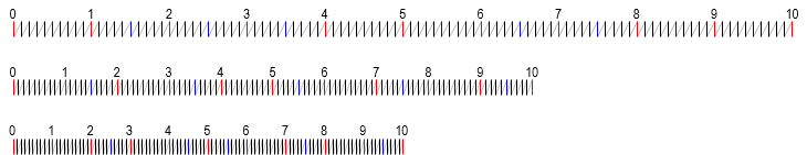
A variable scale is one whose division spacing can be altered. The scale is usually a spring with its coils as the divisions. Generally every fifth and tenth coil are alternately colored. As the spring is stretched or compressed, coil spacing changes uniformly, Figure E-4.
 |
| Figure E-4 Variable Scale Behavior |
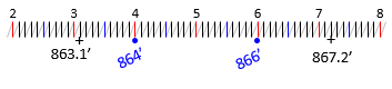
The spring is mounted on a rigid frame with a straightedge. It is laid between two points and the scale adjusted to match the elevation readings at each point. Intermediate points can then be accurately plotted. In Figure E-5, the scale is adjusted so the 3.1 division is on 863.1 and 7.2 division is on 867.2.
 |
| Figure E-5 Using a Variable Scale |
864 is plotted at 4 and 866 at 6. No measuring, no comps.
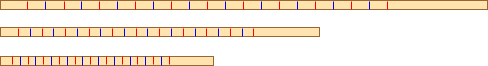
Variable scales are few and far between and expensive when found. An inexpensive, and effective, alternative, is a rubber band. The rubber band is stretched over a 10-scale and marked every 1/2 inch with an ink pen (alternating colors works well), Figure E-6.
 |
| Figure E-6 Making a Variable Scale |
Removing the rubber band will return it to its original size and the divisions will get closer together uniformly. It behaves like a variable scale when stretched, Figure E-7.
 |
| Figure E-7 Rubber Band Behavior |
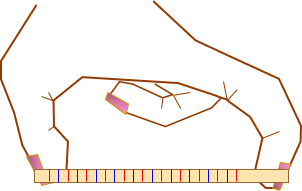
An easy way to use the rubber band is to stretch it over the thumb and index finger of one hand, Figure E-8.
 |
| Figure E-8 Using a Rubber Band Variable Scale |
Flexing the fingers will vary the scale.
b. Estimation
Because plotted distances are so short, most people can quickly estimate interpolated positions. This is fast and generally accurate enough for the map's purposes. This is the method most manual mappers employ.