3. Terrain Identification
Contour line configurations over an area allow quick identification of terrain features.
a. Contour Spacing
Contour line spacing indicates steepness or grade. Closer contours indicate a steeper surface than contours further apart.
In Figure D-22, Line A is steeper than Line B; both have the same elevation change, but Line A does it over a shorter distance.
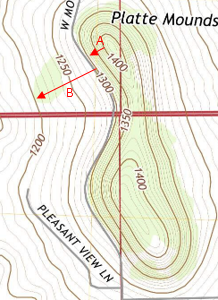 |
| Figure D-22 Contour Spacing |
The steepest slope is perpendicular to contour lines.
b. Major Features
Southwestern Wisconsin, where the City of Platteville is located, is in the Driftless Area, a non-glaciated part of the state. Because glaciers did not scour the area, terrain is relatively rugged (by Midwestern standards) consisting of many valleys and ridges.
Figure D-21 is a portion of topoquad area southwesterly of Platteville.
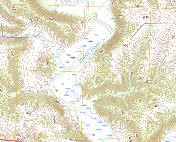 |
| Figure D-21 Platteville Area Topoquad |
Figure D-22 indicates some major terrain features which can be identified from the contour line configurations.
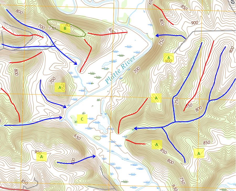 |
| Figure D-22 Terrain Features |
Blue lines are streams and valleys. Arrows show downhill or flow directions. Contours crossing streams and valleys are typically V-shaped with the bottom of the V pointing upstream.
Red lines are ridges, located between stream and valleys. Contours on ridges are generally U-shaped with the open part of the U pointing uphill.
Concentric contours indicate hilltops or depressions, depending if elevations increase or decrease inwardly. Hilltops are labeled A in Figure D-22.
A saddle, B, is two hilltops close to each other separated by a valley.
The ridges and valleys have closely spaced contours indicating steep slopes. Running north-south through the area is the Platte River, a major waterway. The area around the river is its flat floodplain so has very few contours, C.