2. North American Vertical Datum of 1988 (NAVD 88)
a. Need for an Updated Datum
By the early 1970s the level control network had grown appreciably. But studies indicated the network was no longer meeting user needs. Although the bench marks existed on paper, many were destroyed or their height had changed due to crustal movement. Forcing contemporary level circuits to fit the datum affected new bench mark elevation accuracy.
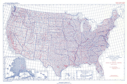
Many destroyed bench marks were replaced and approximately 100,000 km of new lines were run. Figure D-10 shows the vertical network by 1984.
 |
| Figure D-10 Vertical Networks by 1984 |
b. Datum Constraints
A primary concern for NAVD 88 was existing Federal map products in particular FEMA flood maps and USGS maps. Major or inconsistent elevation change could affect flood projections on FEMA maps which in turn affect flood plain insurance. USGS 7-1/2 minute topoquads were widely used for many applications and elevation variations would seriously impact the vertical information depicted.
To prevent warping the new datum, only one tide gauge station, Father's Point (aka, Rimouski, NSRS PID TY5255) in southeastern Canada, Figure D-11, was held fixed. It was chosen to minimize the NGVD 29 to NAVD 88 elevation differences.
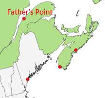 |
| Figure D-11 Father's Point |
c. Results
In Status of NAVD 88 Datum Definition, part of the collection of papers in The New Adjustment of the North American Vertical Datum, 1996, NAVD 88 Project Manager David B. Zilkowski stated:
"Finally, an important aspect to emphasize is that the bench mark height changes that will result from the NAVD 88 readjustment are primarily dues to better estimates of height differences, not because of a change in datum definition philosophy."
NAVD 88 was a refinement of NGVD 29 and, like its predecessor, was not a true geoid or sea level representation. It did, however, make the overall network more consistent.
Figure D-12 shows the elevation change from NGVD 29 to NAVD 88.
 |
| Figure D-12 Elevation Change NGVD 29 to NAVD 883 |
3 Special Publication No. 166 Geodetic Operations in the United States Jan 1, 1927 to Dec 31, 1929, Bowe.
Maximum CONUS difference is 5 ft in western Colorado. To a degree that makes sense as that area is in the Rocky Mountains (a mass anomaly) and inland from the tide stations.
d. So That's It, Right?
Well ... no. Recall that NGVD 29 wasn't the geoid and NAVD 88 was an NGVD 29 refinement so isn't the geoid either.
GPS, which wasn't operational when NAVD 88 was adopted, allows accurate ellipsoid height determination. Since the datum adoption, gravity measurement sophistication and accuracy has evolved. Both technologies facilitate better geoid modelling. Figure D-13 shows the approximate error in NAVD 88 based on satellite gravity data.
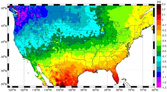 |
| Figure D-13 NAVD 88 Error4 |
4 Geodesy for the Geographer : Vertical Datums for the Floodplain Manager, URISA GIS-Pro Conference, 2023, J. Jalbrzikowski
NAVD 88 appears to be tilted about a southwesterly axis.
NAVD 88's primary issues are station marks, datum adoption, adjustment control, and purpose
Station marks - Many marks/monuments are inaccessible, damaged, or missing. NGS does not have sufficient funding nor field crews to physically maintain marks.
Datum adoption - It is not a true North American datum as Canada has never adopted it. It does extend across Canada to Alaska, however there isn't much control in Alaska.
Adjustment control - to minimize overall datum-to-datum elevation changes, only a single point was used to fix the adjustment. That point was at the extreme northeast corner of the network. The further from it the faster errors accumulated.
Purpose - Rather than creating a better 0-elevation equipotential datum, NAVD 88 was intended to maintain close compatibilty with NGVD 29. It was not a true datum creation process.
So the vertical datum saga continues. Keep tuned in...