2. Conversion
a. Defined
A conversion is based on an exact and rigorous mathematical relationship between the two coordinate systems. When a position is converted no error is introduced beyond that already in the source coordinates. If the source positions are good to ±0.1 ft, then so are their converted results. The position accuracy is neither increased nor degraded.
b. Forward and Inverse conversions
State Plane coordinates (SPC) and Universal Transverse Mercator coordinates (UTM) projection systems are linked mathematically directly to the ellipsoid. A point position can be expressed in geodetic coordinates (latitude and longitude) or grid coordinates (N/E, X/Y).
A Forward conversion creates grid coordinates from geodetic; an Inverse conversion creates geodetic from grid. The process is shown graphically in Figure N-1.
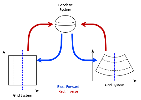 |
| Figure N-1 Geodetic-Grid Conversions |
What if a user had UTM coordinates of a point and wanted its SPC? Each grid is mathematically connected to the ellpsoid. None are directly tied to a another grid system. To convert UTM to SPC is a two-step process. Refer to Figure N-1:
(1) Inverse conversion from UTM to Geodetic (red arrow)
(2) Forward conversion from Geodetic to SPC (blue arrow)
UTM and SPC are independently defined so there is no rigorous link between them.
Forward and inverse conversions and their combinations are exact within a datum, Figure N-2.
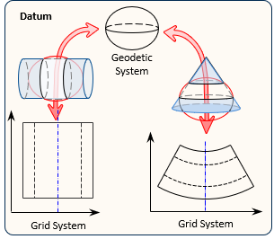 |
|
Figure N-2 |