Page 1 of 4
F. Universal Transverse Mercator System
1. General
The Universal Transverse Mercator (UTM ) System is collection of 60 adjacent cylindric map projections circumventing the earth. It was adopted in 1947 by the US Army for world-wide military map creation. Each projection, or zone, is 6° wide and runs from 80° S latitude to 84° N latitude (the Poles are covered by plane projections).
Zones are numbered 1 to 60 from west to east, Figure F-1. Each zone is divided into 20 blocks lettered C to X from south to north.
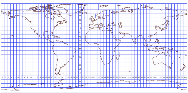 |
| Figure F-1 UTM Zones |
Table F-1 shows the zones pattern: ID, longitude span, and CM longitude.
| Table F-1 UTM Zones |
||
| Zone |
Span |
CM |
| 1 | 180°W-174°W | 177°W |
| 2 | 174°W-168°W | 171°W |
| ... | ||
| 30 | 6°W-0° | 3°W |
| 31 | 0°-6°E | 3°E |
| ... | ||
| 59 | 164°E-174°E | 171°E |
| 60 | 174°E-180°E | 177°E |