Chapter B. Survey Surfaces
Regardless the kind of equipment or type of survey, there are two surfaces surveyors have always used with when making measurements: physical earth and geoid.
1. Physical earth - Ground
This is the surface on which we set up equipment and perform measurements, Figure B-1.
 |
| Figure B-1 Physical Earth |
We can get away with assuming a flat plane reference, Figure B-2, with parallel vertical lines over small areas.
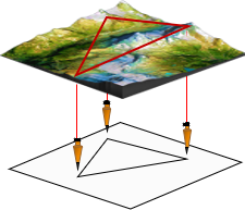 |
| Figure B-2 Plane Surveying |
The distortions introduced are within acceptable (often negligilble) limits.
Once we go "longer" distances, Figure B-3, the Earth's non-mathematical irregular shape rears its ugly head.
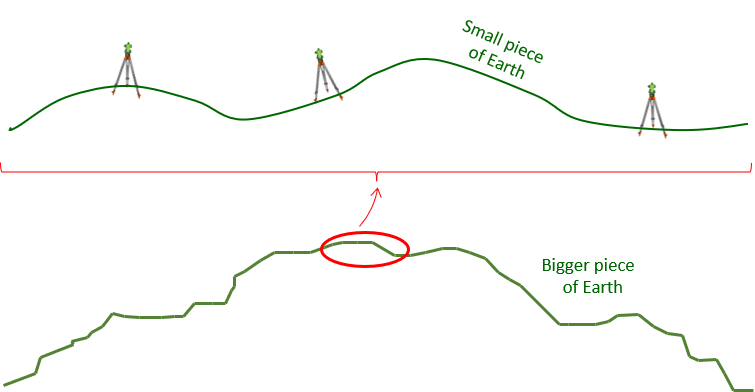 |
| Figure B-3 Large Area |
What constitutes "longer" distances? The short answer is: any distance at which distortion size becomes unacceptable.
Over large areas, vertical lines aren't parallel (nor are they straight) because the Earth isn't flat, the surface isn't stable, and it's non-mathematical. Using a flat reference plane introduces errors that are difficult to control and compensate, Figure B-4
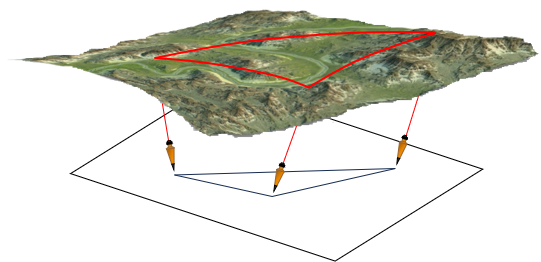 |
| Figure B-4 Distorted Survey |