3. The Orthoimage
An orthophoto is an aerial photo projected to datum; orthoimage is a generic term referring to either a photo or digital product. Why ortho? It's short for orthographic which means "at right angles to": a map, for example, is everywhere perpendicular to vertical lines. An orthoimage would be the same.
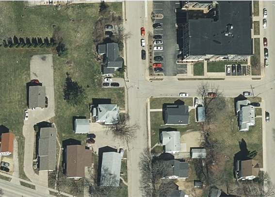
The processes to create a physical orthoimage are beyond the scope of this Topic. What is important to understand, regardless the process used, is that some compromises are made due to cost or process limitations. The most visible are buildings that lean, like radially displaced images on a regular photo. Figure H-8 is a digital orthoimage created using image processing software.
 |
| Figure H-8 Orthoimage |
The orthoimage terrain has been projected to datum but some vertical sides are still visible and building tops are offset from their footprints. This is a cost trade-off: the amonut of processing necessary to remove building height displacement increases orthoimage project costs considerably. Everything else in the orthoimage is planimetrically correct.
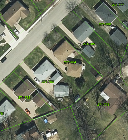
Many local GIS use digital orthoimage base maps. In dense residential areas with narrow parcels, Figure H-9, it may appear that buildings cross lot lines.
 |
| Figure H-9 Boundary Encroachments? |
The apparent encroachment is strictly visual because building height relief displacements were not removed in the orthoimage creation process. The building footprints are in their correct locations, even if not fully visible. Users unfamiliar with aerial image optical geometry and relief displacement characteristics may find orthoimages confusing and seemingly contradictory with other combined data.