Page 1 of 3
H. Orthophotos
1. General
A map has a constant scale, an aerial photo rarely does. As discussed previously, photo scale is a function of elevation, Figure H-1.
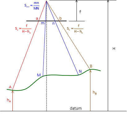 |
| Figure H-1 Variable Photo Scales |
For a photo to have a uniform scale throughout requires that all its image points be at the same elevation, Figure H-2.
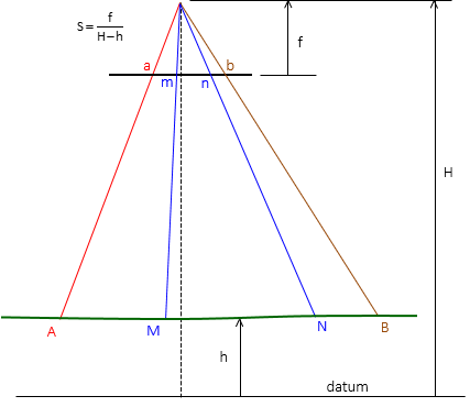 |
| Figure H-2 Constant Photo Scale |
Essentially flat terrain has a uniform photo scale - at the terrain's elevation. Higher and lower flat terrain have different uniform scales. Elevation still plays a part with photo scale. Even with flat terrain at a specific elevation, there's still the issue of relief displacement.