E. Neat Model
1. Endlap and Sidelap
To see a 3D model requires overlap between successive photographs, Figures E-1 and E-2.
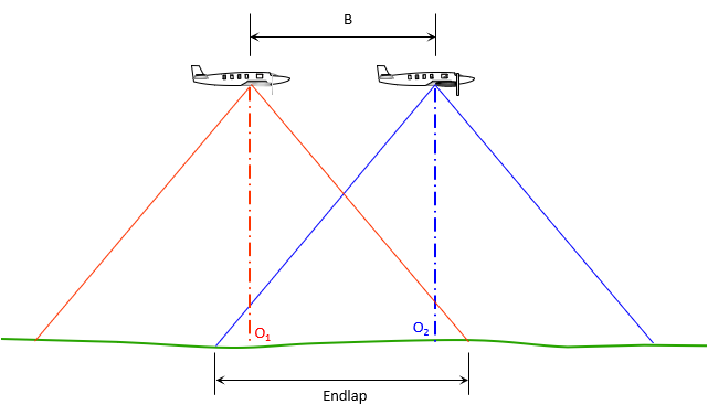 |
| Figure E-1 Endlap - Flight |
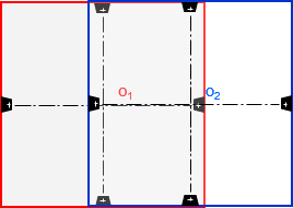 |
| Figure E-2 Endlap - Photos |
B is the airbase, the distance between successive exposure points.
How much overlap is needed? For most mapping photography 60% or more is used so the principal points of both photos (o1 and o2) are in the overlap area. Including both principal points helps identify the actual flight path.
What about using 100% overlap? Not possible unless the camera is in a stationary helicopter or drone. If it is, then a 3D model isn't possible because the perspective doesn't change. The greater the overlap, the more photos needed to cover the same area. Maximum overlap is limited to about 75%.
Most aerial photography is flown in strips so their overlap is referred to as endlap (photos are end-to-end).
Adjacent strips are also overlapped but not to the same extent. Sidelap, Figures E-3 and E-4, is typically 15-30%.
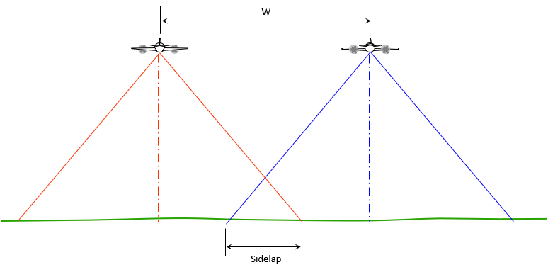 |
| Figure E-3 Sidelap - Flight |
 |
| Figure E-4 Sidelap - Photos |
W is the distance between adjacent flight lines.