Page 2 of 3
2. Plane Surveying
Plane surveying is based on a presumption that the earth’s surface is flat, a plane, Figure C-2.
-

Figure C-2
Plane Surveying
Using a flat two dimensional reference surface simplifies many computations. Lines are straight and related to angles by plane trigonometry. The angle sum for any triangle is 180°00’00” regardless the combination of sides and angles, Figure C-3.
-
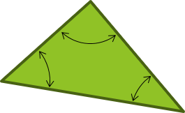
Σ(angles) = 180°00’00”
Figure C-3
Plane Triangle
Over small areas, plane surveying principles may be used without introducing significant errors.
Since the reference surface is flat, gravity directions (and hence vertical lines) are everywhere parallel. Horizontal lines are perpendicular to gravity along their entire lengths, Figure C-4.
-
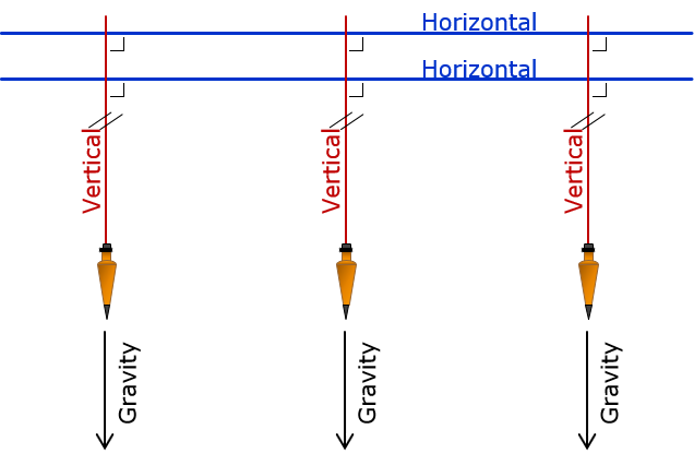
Figure C-4
Vertical Lines in Plane Surveying