Solution: Stereo Photos
Problem (1)
A set of stereo photographs were take at a height of 3850 ft above datum with an airbase of 1100 ft. Coordinates on the photographs of two points, H and K, were measured as:
| Left photo | Right photo | |||
| Point | x, in | y, in | x, in | y, in |
| H | 0.88 | 2.79 | -1.31 | 2.74 |
| K | -0.81 | -2.27 | -3.17 | -2.31 |
Part (a)
Which point is at a higher elevation? Why?
The larger the parallax distance, the closer the object to the camera. The parallax for point K is greater than A’s so K is at higher elevation.
Part (b)
What is the horizontal ground distance between the two points? Determine to nearest 10 ft.
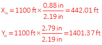
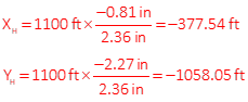
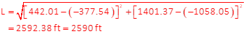
The length is 2590 ft.
Problem (2)
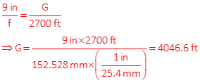
In order to achieve at least 65% endlap, what airbase must be used for a 152.528 mm focal length camera with a 9 inch by 9 inch negative format flown at 2700 ft above terrain level? Terrain is relatively flat.
Sketch of linear distance covered by one photo
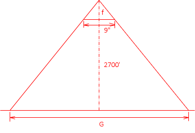
Sketch of overlapping photos
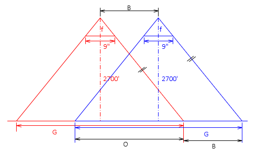
Using the parallel condition indicated on the sketch:
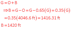
Airbase is 1420 ft.
Problem (3)
Photography is flown using 60% endlap and 30% sidelap between flight lines. Average terrain elevation is 1250 ft and flying height was 3000 ft above datum. What is the ground area, in acres, covered by a neat model? The camera had focal length of 6.00 inches and 9 inch square negative format.
Refer to the sketches
A photo's ground cover is G. The length of the neat model is the airbase, B, which is 40% of G. Because the neat model extends halfway into the sidelap on both sides, it is 70% of a photo's ground cover, G.
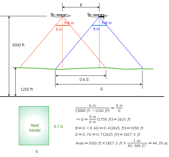
The neat model area is 44.29 acres.