Solution: Geodesy
Problem (1)
Near Poniatowski, WI, is a small park with a special marker. The marker is at the intersection of Lat 45°N and Long 90°W, the center of the Northwest hemisphere.
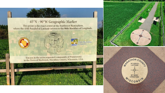
The orthometric height of the mark is 420 m
Part (a) Determine the Terrestrial Reference System X, Y, Z coordinates for this point.
There are two ways to do this: Use NCAT or manually solve the equations.
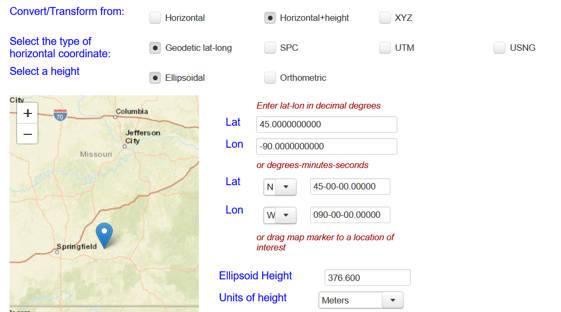
Either way, you need the ellipsoidal height at the mark. Use GEOID18 in the Geodetic Tool Kit to get geoid ht: N = -33.385m. Ellipsoidal height: h = 420+(-33.385) = 386.615 m
Using NCAT
NCAT needs Ellipsoidal ht to compute X, Y, Z; it will not compute the coordinates if an orthometric height is provided.
You input screen should look like this:
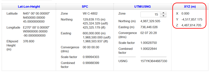
After clicking Submit, scroll down and check the output
Manual Computation
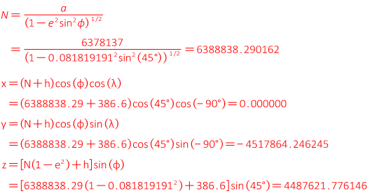
Part (b) What are the radii in the meridian and prime vertical?
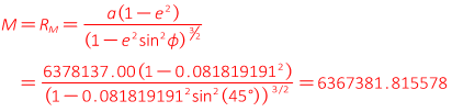
Radius in prime vertical the same as in part (a): 6388838.290
Part (c) What is the LaPlace correction at this location?
Run DEFLEC18 in the Geodetic Tool Kit: -7.13"