Solution: Coordinate Systems
Problem (2)
A survey in southwestern Missouri was referenced to the state's West SPC zone. The adjusted coordinates and scaled elevations of two surveyed points are shown in the following table.
| Point |
North (m) |
East (m) |
Elev (m) |
| Bobo |
63,690.932 | 916,159.330 | 445 |
| Nancy |
64,097.181 | 915,857.743 | 470 |
Geoid height in the project area is -28.7 meters.
What is the horizontal ground distance between the points?
Solution
Steps
(1) Compute grid distance from coordinates
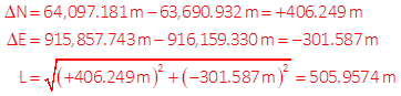
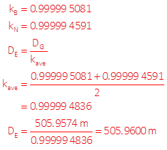
(2) Convert grid distance to geodetic
Use NAD83 Coord Conversion workbook to determine SPC grid scale at both points.
Divide grid distance by average scale to get geodetic distance.
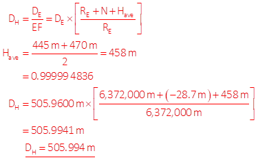
(3) Convert geodetic distance to ground
Use average elevation to compute EF.
Divide geodetic distance by EF to get ground.